You are currently browsing the tag archive for the ‘Environment’ tag.
Located in the middle of South China Sea, between east (Borneo) & west (Peninsula) Malaysia, lies the stunningly beautiful archipelago of Natuna Islands.
Officially a part of the Riau Archipelago province, Natuna Islands is actually the northernmost group of islands of Indonesia. This 272-islands archipelago is indeed a true and true ‘eden’ of the sunken Sunda Shelf of the Malay Archipelago!
The ‘eden’ of Natuna Islands are the ‘scattered’ mountainous parts of the sunken Sundaland/Sunda Shelf which had managed to stay ‘afloat’ above the sea level.
Well…you see…at the height of the Last Ice Age (about 20,000 – 18,000 years ago), almost all of the South East Asia lands and seas (ie the Gulf of Thailand and the Java Sea) were all dry and thus formed a continent twice the size of India – called Sunda Shelf or Sundaland.
Dramatic and catastrophic rise in water level occurred between 8,000-7500 years ago (at the end of the Last Ice Age – the 3rd Great Flood).
Experts claimed that record shows that the sea indeed rose at least 120 metres during those 3 Great Floods! The flooding of South East Asia resulted in major loss of parts of the flat land of the Sunda Shelf.
Now…back to the present time… the archipelago of Natuna Islands offers unspoiled beaches – with landscape & culture that is absolutely worth a visit! They are also famous for their lovely woven textiles. And not forgetting… those graceful and mesmerising traditional dances too.
Natuna Besar Island (or locally known as ‘Ranai’) is the largest in size and also northernmost of the islands. Mount Ranai in the island is the highest mountain in the Natuna Archipelago (1,035m). It also has extensive accommodation facilities, ie hotels, resorts and inns. Despite of its size, Ranai town is indeed quite a lively place. There are traditional markets, large supermarkets and also modern medical facilities available on the island.
 According to local historians, the 1st ever habitant of Natuna Besar Island was a young boy from Siam (present day Thailand). He was ‘swept away’ on a log and marooned on the island. The boy was later known as ‘Demang Megat’. He was later married to a princess from the Kingdom of Johor (southernmost state in Peninsula Malaysia) by the name of Engku Fatimah.
 The archipelago of Natuna Islands are vitally important due to the fact that they actually sit in waters that carry MORE than HALF of the world’s supertanker traffic! And of course, fisheries resources are enormous!
But more importantly… very, very significant reserves of oil and gas are believed waiting to be exploited right under the sea! Indeed, some claimed that the largest gas fields in the WORLD has been found… right here!
So how one gets to enjoy the magical beauty of this ‘floating Eden’ of the sunken Sundaland? Well, the easiest way is to fly. Go to Batam and head straight to Hang Nadim Airport. The small Fokker aircraft seats 45 passengers and takes about 1.5 hours to reach Ranai Airport on the Natuna Besar Island. The price? US8O per pax/one way.
Alternative mode of transport? Well… you can ride a boat from Kijang Harbor of Tanjung Pinang, Bintan Island. The boat takes 12 hours to reach Natuna Besar Island and the service is available only once a week! Not a bad idea if you want to be ‘marooned’ for 7 days…continuously… on a lost- lovely- island of ‘eden’ of the long forgotten sunken Sundaland…:) Awesome!
Niah in Sarawak, Malaysia and the Nile of Egypt…two places which are vastly separated by lands, seas, cultures, traditions and peoples. And yet, when I visited Egypt not so long time ago I was astonished to find one obvious similarity in the ancient traditions of these two exotic lands…the burial ceremony of their loved ones… the ritual performed onto those ‘lovely bones‘ of the deceased dwellers of Niah and the Nile.

The wall paintings found in the Painted Cave of Niah depicting the boat journey of the dead into the afterlife. A feature in traditions shared by both the dwellers of Niah and the Nile...?
I had actually paid a visit to Niah some years prior to my holiday in Egypt. Back then, Niah was not as popular as a tourist destination as it is now. Hence, it was not a ‘smooth sailing’ event for me to get there. From Miri town (distance-110km) I had to take a bus to a place referred to as ‘Niah Rest Stop’. It was located on the Miri to Bintulu road. There was no direct bus from Miri (or even from Bintulu – distance:131km) to Niah then.

Niah Cave has 8 entrances - the biggest is the west entrance, also known as the 'WEST MOUTH' - one of the world's most spectacular cave entrances!
From ‘Niah Rest Stop’ I then hopped into a minibus to take me to the Niah Park Headquarter located in a place called Pengkalan Batu (about 3 km from Niah). I had to pay RM10 for the Park’s Entrance Fee (only RM5 for Child) and another RM5 for Camera Permit (and RM10 if you take a videocam with you).
 Now…to get to the cave, I had to take a small motorized ‘sampan’ to cross the Niah River.
Cost only RM1 per pax then. Not sure how much it costs now.
 After safely reached the other side of the river’s bank, I then I continued walking the 3km plank-walkway. The raised plank-way was built above a dark forest swamp and cut through a dense tropical rainforest.
 Upon finally reaching a cliff, the path started to ‘climb’. It looke like a ‘tunnel’ to me. Soon enough, the ‘tunnel’ opened up into the great ‘Dragon Mouth’… or better known as the West Mouth of the Niah Cave Complex.
The West Mouth is 60m high and 250m wide! It is indeed one of the world’s MOST spectacular cave entrance! It is believed that about 40,000 years ago the cave was populated by prehistoric men. To be precise… the dwellers were of the Paleolithic times (the earliest part of the Stone Age). Indeed, they were believed to be the earliest human in the South East Asia region!
 Today the caves remain important for locals for their birdnests and guano (bat & bird manures/faeces) collection. The birdsnest collectors use bamboo poles and ladders made from Belian wood (ironwood) to climb to the cave’s ceilings. It is believed that there are about 1/2 million swiflets live in the caves!
 Leaving the main cave behind, i then continued to the next ‘attraction’ – the ‘Painted Cave’. I had to pass through another cave called ‘Moon Cave’, walked in almost total darkness for awhile before emerging into daylight. A short trail followed and before I knew it, I was already standing inside the ‘Painted Cave’.
‘Painted Cave’ houses wall-paintings depicting the boat journey of the dead into the afterlife. The site is believed to be the burial sites of people of the Paleolithic and Neolithic times. Set on the cave wall were numerous paintings of ‘boats’ loaded with up to 20 people. Some crumbling dug-out canoes, which had acted as coffins, were also placed against the wall of the cave.
Back then, I had not paid that much attention to the significant of those paintings and ‘death canoes’. And it never crossed my mind that I would be seeing something similar in places thousand of miles apart and some seas away from this humble cave of Niah. The ancient people of these two places seemed to have had shared the same ritual in putting the ‘lovely bones‘ of their loved ones to rest. And…’that’ other place I meant was no other than … the land of pyramids, pharaohs and the Nile… Egypt!
…of Niah & Nile
QUICKIES
There are now direct buses to Batu Niah from Miri and Bintulu…
Miri – from the Miri Bus Station – ‘quite’ regular – 1 hr to 2 hrs journey time
Bintulu – from the Bintulu Bus Station – 2 to 3 hrs journey time
Batu Niah to Niah HQ (Pengkalan Batu) – there are 3 alternatives:
1) motorized boat
2) taxi
3) walking – 45″ stroll along the riverbank
The Niah Cave Park opens from 8am to 5pm.
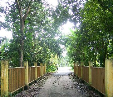
I chose a small town called ‘Pekan’ to be featured in this very 1st post of mine for many reasons. Yeah… mostly they are personal. This is the town where I had spent the first 7 years of my life. My earliest ‘playground’. Indeed, my very first ‘playground’ in the vast region of the Malay Archipelago.
And boy oh boy… I had so many playmates to go around with back then… never mind the fact that they were all my uncles, aunties, cousins, second cousins and so on. In short, they were all, somehow, related to me.
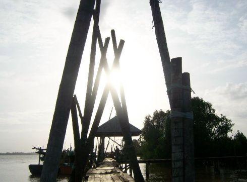
Sunset at a Traditional Jetty, Pekan
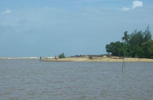
Where the river meets the sea... estuary at Pekan
But that was how it was for almost everyone else in Pekan too, back then. A small charming, serene little ‘cowboy-town’ which was populated mostly by one’s relatives!
I went back to Pekan recently for a brief stay. And… off course… I could no more claim any Mat, Minah and Mail whom I met was my uncle, auntie or cousin.
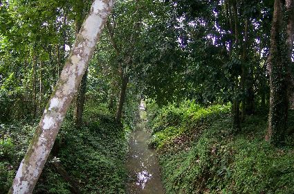
A serene looking drain that runs through a village in Pekan
These two pictures here are examples of the many, many beautiful sites found in and around the Malay Archipelago region. The region showcases hundreds of exotic spots like waterfalls, natural hot springs, islands, beaches, highlands and many many more. Heavenly good retreat sites for one’s soul!
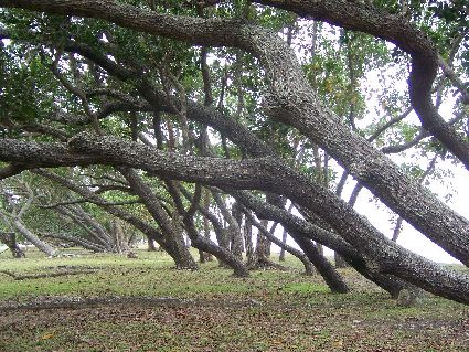
'Bow-Down' trees at a beach in Pekan
In short, there are many, many more people in Pekan now. And many, many of these many, many people originally come from other parts of Malaysia (or even … from other countries!).
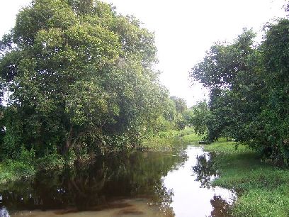
A water-canal in Pekan
Parts of Pekan town have also gone through some changes and developments. I guess it is for the sake of improving lives and economy of the residents. Very noble intention, indeed. But I was getting a little bit worried if the rustic charm of the ‘old’ Pekan would eventually be ‘sacrificed’ in the name of progress and modernisation.
I re-visited some of my ‘all-time-favourite-spots’ in and around Pekan. I was relieved to see that most parts of these sites were left quite ‘untouched’ .
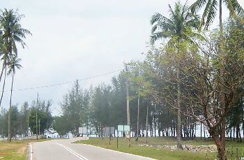
A road by the sea, Pekan
And while I was there, almost immediately, I was taken back to the time when I was still very small, running around and abound accompanied by my many, many uncles, aunties, cousins, second cousins and so on. Awesome!
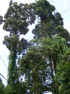
The 'Twin Towers' of Pekan
I stumbled upon these two very tall trees in a village called ‘Parit’ in Pekan. They reminded me of those ‘other’ tall structures back in the city… the PETRONAS Twin Towers 🙂
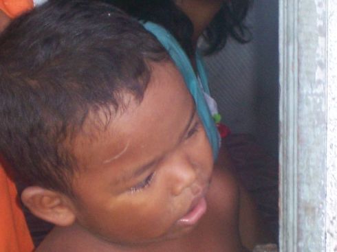
An 'Orang Asal' (Aborigine) Boy
Where on earth is PEKAN?
Pekan is located on the east-coast part of Peninsular Malaysia. It is about 4 hours drive from Kuala Lumpur.
How to get there?
From Kuala Lumpur, take the Karak Highway and then continue the journey on the East Coast Highway. Exit at Gambang and continue on the trunk road leading to Kuantan town. Take Note: Before reaching Kuantan, look out for ‘Pekan’ signboard. Follow the direction (you need to make a ‘U’ turn and almost right away after that to turn to left) and you will be in Pekan in no time at all.

- Me and ‘Mini Tsunami’


