You are currently browsing the tag archive for the ‘Malaysia’ tag.
Berhala Island, or better known as ”Pulau Berhala’ by locals, is definitely not a ‘Shutter Island’. At least not in this century!
That ‘hellish’ island depicted in Martin Scorsese’s ‘Shutter Island’ is far too ‘gruesome’ in comparison to this awesomely unique ‘tropical eden‘ of Berhala Island.
But then again… the condition on the Berhala Island might not had been like how it is now in the last century. Back then… it might had looked like as ‘chilling’ as something out of a scene from ‘Shutter Island’ instead!
Berhala Island indeed had been used as a ‘quarantine station’ for labourers from China and Philippines before the WW2 era.
It was later turned into a colony of leper patients.
Then the WW2 happened. The Japanese turned Berhala Island into a POW camp. A lady by the name of Agnes Newton Keith was among the many POWs held here…
Agnes Keith was an American author best known for her 3 autobiographical books which related her accounts of life in a place simply referred as ‘North Borneo’ … the present time Sabah.
One of these, called ‘Three Came Home’ was made into a film in 1950. Produced by 20th Century-Fox and directed by Jean Negulesco, the film was hailed by a New York Times viewer as “shocking! disturbing! will tear your heart out…but it will fill you fully with a great respect for a heroic soul!”.
 Now… back to the present time… Berhala Island is indeed a wonderful place to visit. Swimming, snorkelling, sightseeing, jungle trekking and even ‘rock climbing’ are some of the activities one can do when visiting this forested little island.
The most striking feature of Berhala Island is the awesome dusky-pink range of cliffs that drop straight into the water! And of course…it is also blessed with white fine sandy beach and crystal clear water. And no… no traces of POW camp or whatnots:)
 I’m not sure how other visitors made their way to Berhala Island. As for me, this is what I did. I first went to the fish market located at the jetty in Sandakan town. There I asked if any of the fishermen ( while they were still in their boats) willing to take me for a ’round-tour’ to the Berhala Island.
Within minutes I already had someone willing to do so and wanted to charge me RM10 for the service! What? Only for RM10? And I could have the boat all to myself? He seemed very sincere and equally excited as I was… so without a second thought I accepted his kind offer.
He first took me for a ‘short tour’ to a nearby Sim Sim Village. This was a ‘water village’ located adjacent to the fish market.
From Sim Sim Village he then took the boat across the Sandakan Bay and headed straight to Berhala Island.
The island was located about 8 km from the jetty (of the fish market) of Sandakan. And it took only 15 ” from Sim Sim village to go to Berhala Island. My first stop was the water village of Berhala Island.
He then took the boat for a ’round tour’ of the island. Berhala Island is about 5ha in size. So, it is a very tiny island, indeed.
The water village is located on the west part of the island. And to the north is where the most striking feature of the island is to be found – the dusky red/pink color sheer cliff that seemed to rise out of the deep blue sea! This tall & towering cliff is estimated to be about 600′ high.
It was already getting late in the evening by the time we reached that lovely ‘picnic spot‘ of Berhala Island. So I did not have the opportunity to enjoy a swim at this lovely white sandy beach. I would love to come back here again soon. To me, Berhala Island is truly a lovely tiny eden in the Bay of Sandakan. And… ‘Shutter Island’ this place is definitely not:)
Batu Caves ROCKS! Well…at least that’s how I felt of my recent visit to the site. The last time I visited Batu Caves was about 20 years ago! Except for some religious purposes (for the Hindus) there was nothing really one could do at Batu Caves back then… other than to look at and admire some of the odd and unique rock formations. So when some friends invited me for a half-day ‘excursion’ to Batu Caves recently, I went along because I wanted to see how much Batu Caves has changed.
When we arrived at the main gate of the Batu Caves complex, we were ‘greeted’ by a tall golden statue of Lord Murugan.
Standing at 43meter (135 feet) this is claimed to be the tallest statue of Lord Murugan in the world!
Completed in January 2006, the statue cost RM 2.6 million to build and used 1,550 cubic metre of concrete and 300 litres of gold paint.
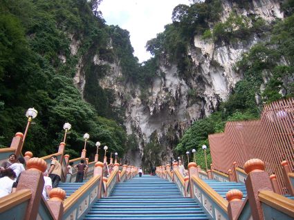
Now…to reach the main cave, which is popularly referred to as the ‘cathedral cave’, one needs to climb up those 272 steps. But not to worry, the view one gets as one goes higher is worth the climb! Tired? Loosing the breath? Well…take a break! Sit on the step and enjoy the scenery:)
The last time I was here I could not enjoy this luxury:( It was on a Thaipusam day and there were millions of people (devotees and curious visitors like myself) climbing those steps… all at the same time! I did not even have to ‘try’ to climb…I was literally ‘pushed’ from the 1st step on the ground all the way to the final step on the top… by the crowd! Talk about good ‘vibes’ and ‘energy’…:)
Located at the top of the staircase is actually the main cave.
My friends and I continued venturing deeper into the cave.
The cave formations were really wonderful. Long stalactites hanging down from the ceiling. Stumpy stalagmites rising up from the floor.
I was also informed that these stalactites and stalagmites were indeed still very much alive! And growing! Whoa!
It is also claimed that the rock forming the cave is actually 400 million years old! Indeed, I was told that the cave itself is about 60-100 years old. But the most fascinating fact I found was that the limestone rock (of the cave) was originally formed from layers of shells and corals once UNDER the sea! They were then uplifted into hills and mountains!
We also found a strange looking rock formation at the most end side of the main cave. Strangely enough, this unique shaped rock (…or rather stalactite) remind me of my trip to Koh Sa Mui in Thailand. Over there I found a rock formation which was almost similar to the one in Batu Cave. The only difference is… Koh Sa Mui’s rock stood erected by the sea while this one in Batu Cave was found hanging down from the ceiling…
Now… compare with these photos I took @ Koh Sa Mui, Thailand…
We ended our day at the Batu Cave with a stop at a small cafe located in the complex.
I ordered a cup of ‘teh tarik’ (tea with milk – done in a very ‘Malaysian’ style) and … soon after I found myself ordering another cup of the same thing! The reason? That was the best ‘teh-tarik’ I’ve ever tasted in Kuala Lumpur… ever!
On the way out, we came upon a group of people actively participating in rock climbing activities. Well… this only proved that there are actually lot of things one can see and do when visiting Batu Caves nowadays. Cave exploration, rock climbing, nature walk-about … just to name a few. And of course, on a Thaipusam day, you can watch the colorful and fascinating ‘kavadi’ parade too.
So… if you visit Kuala Lumpur I would recommend you to include Batu Caves in your ’10 Things Must See in KL’ list simply because… Batu Caves ROCKS!
Niah in Sarawak, Malaysia and the Nile of Egypt…two places which are vastly separated by lands, seas, cultures, traditions and peoples. And yet, when I visited Egypt not so long time ago I was astonished to find one obvious similarity in the ancient traditions of these two exotic lands…the burial ceremony of their loved ones… the ritual performed onto those ‘lovely bones‘ of the deceased dwellers of Niah and the Nile.

The wall paintings found in the Painted Cave of Niah depicting the boat journey of the dead into the afterlife. A feature in traditions shared by both the dwellers of Niah and the Nile...?
I had actually paid a visit to Niah some years prior to my holiday in Egypt. Back then, Niah was not as popular as a tourist destination as it is now. Hence, it was not a ‘smooth sailing’ event for me to get there. From Miri town (distance-110km) I had to take a bus to a place referred to as ‘Niah Rest Stop’. It was located on the Miri to Bintulu road. There was no direct bus from Miri (or even from Bintulu – distance:131km) to Niah then.

Niah Cave has 8 entrances - the biggest is the west entrance, also known as the 'WEST MOUTH' - one of the world's most spectacular cave entrances!
From ‘Niah Rest Stop’ I then hopped into a minibus to take me to the Niah Park Headquarter located in a place called Pengkalan Batu (about 3 km from Niah). I had to pay RM10 for the Park’s Entrance Fee (only RM5 for Child) and another RM5 for Camera Permit (and RM10 if you take a videocam with you).
 Now…to get to the cave, I had to take a small motorized ‘sampan’ to cross the Niah River.
Cost only RM1 per pax then. Not sure how much it costs now.
 After safely reached the other side of the river’s bank, I then I continued walking the 3km plank-walkway. The raised plank-way was built above a dark forest swamp and cut through a dense tropical rainforest.
 Upon finally reaching a cliff, the path started to ‘climb’. It looke like a ‘tunnel’ to me. Soon enough, the ‘tunnel’ opened up into the great ‘Dragon Mouth’… or better known as the West Mouth of the Niah Cave Complex.
The West Mouth is 60m high and 250m wide! It is indeed one of the world’s MOST spectacular cave entrance! It is believed that about 40,000 years ago the cave was populated by prehistoric men. To be precise… the dwellers were of the Paleolithic times (the earliest part of the Stone Age). Indeed, they were believed to be the earliest human in the South East Asia region!
 Today the caves remain important for locals for their birdnests and guano (bat & bird manures/faeces) collection. The birdsnest collectors use bamboo poles and ladders made from Belian wood (ironwood) to climb to the cave’s ceilings. It is believed that there are about 1/2 million swiflets live in the caves!
 Leaving the main cave behind, i then continued to the next ‘attraction’ – the ‘Painted Cave’. I had to pass through another cave called ‘Moon Cave’, walked in almost total darkness for awhile before emerging into daylight. A short trail followed and before I knew it, I was already standing inside the ‘Painted Cave’.
‘Painted Cave’ houses wall-paintings depicting the boat journey of the dead into the afterlife. The site is believed to be the burial sites of people of the Paleolithic and Neolithic times. Set on the cave wall were numerous paintings of ‘boats’ loaded with up to 20 people. Some crumbling dug-out canoes, which had acted as coffins, were also placed against the wall of the cave.
Back then, I had not paid that much attention to the significant of those paintings and ‘death canoes’. And it never crossed my mind that I would be seeing something similar in places thousand of miles apart and some seas away from this humble cave of Niah. The ancient people of these two places seemed to have had shared the same ritual in putting the ‘lovely bones‘ of their loved ones to rest. And…’that’ other place I meant was no other than … the land of pyramids, pharaohs and the Nile… Egypt!
…of Niah & Nile
QUICKIES
There are now direct buses to Batu Niah from Miri and Bintulu…
Miri – from the Miri Bus Station – ‘quite’ regular – 1 hr to 2 hrs journey time
Bintulu – from the Bintulu Bus Station – 2 to 3 hrs journey time
Batu Niah to Niah HQ (Pengkalan Batu) – there are 3 alternatives:
1) motorized boat
2) taxi
3) walking – 45″ stroll along the riverbank
The Niah Cave Park opens from 8am to 5pm.
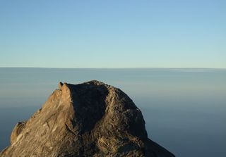 Mount Kinabalu in Sabah is indeed one of the youngest non-volcanic mountains in the world! Its majestic peak tops out at 4,095m and is easily recognized as the highest mountain in the Malay Archipelago region.
Now… many of us have seen that ‘horrifying’ sequence trailer of the very much anticipated ‘2012’ movie (attached below). And some even commented that if ‘ it’ was really to happen… would Mount Kinabalu be the safest bet to escape that catastrophic event within this region?
Errr… wellll… I don’t know about that. Indeed I don’t really believe that it would actually happen (as depicted in the movie). But then again… in this post I would like to share with you my own experience of climbing this gorgeous mountain. Yeah, it was yearsss ago when I first ascended the summit of Kinabalu. So, be warned, some of the photos you see here are quite old, really:) But the experience has always been fresh and new on my mind… forever.
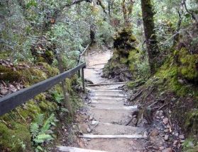
Stairways to Heaven...
Good thing is, no climbing experience is really required to conquer the peak of Borneo… that is if you take the main route. So, like many other ordinary average people, I started from the main starting point located in the Kinabalu Park. The park is located less than 2 hours drive from Kota Kinabalu, the capital city of Sabah.
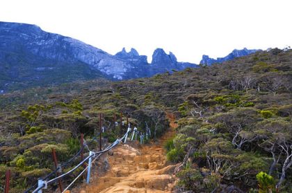
When the going gets tough...
Average person, me very much included…:) takes about 4 to 6 hours to reach about 3/4 of the way to the summit. This mid-way spot is called Panar Laban(3,270m).
I was also informed that presently the Sabah Parks limits the number of climbers to only 192 people a day. Why such an odd figure, eh?
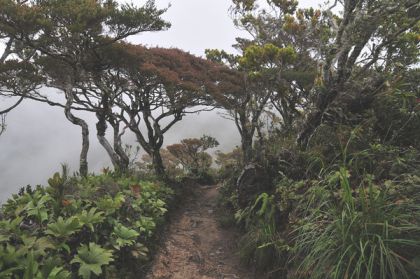
Dreamy Ascend...
Anyway, given the popularity of the Mount Kinabalu, it is advisable to book your adventure/climbing at least 3-4 months in advance! Indeed, some have claimed that they have to book as early as 6 months prior the climbing! Whoa! Try to beat that! Truth is… Mount Kinabalu is really, truly that immensely popular. And why not? The site has even been declared by UNESCO as a WORLD HERITAGE SITE. So there you go…
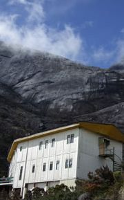
Finally... after 4 hours of climbing... catch the glimpse of your 'Reward-Of-The-Day'!
I finally reached Panar Laban where I stayed overnight at the Laban Rata Rest House. Mind you, camping is a big ‘NO, NO!’ (as strictly stipulated in the National Park’s rules & regulations). So, you are left with the choice of very limited accommodation choices. There are actually other accommodations ‘available’ beside the Laban Rata Rest House, ie ‘Gunting Lagadan’ and ‘Sayat Sayat Huts’. And that’s about it:( So, sadly, in the event that there is no accommodation available here, it is not possible for you to continue with your climbing plan. And, oh yeah, a Mountain Guide is compulsory.
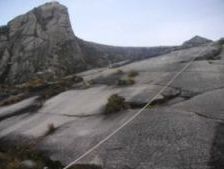
Now... the 'real' climbing starts
At that time I had to pay only RM30 for a bed (in a dorm). And RM10 for dinner… a bowl of Instant Noodle Soup! I thought that was already wayyy too much for me. But listen to this… the current price for a bed plus meals (a packed box, buffet lunch, dinner & breakfast) for one person is a whopping RM330! And this rate is valid for Malaysians, Permanent Resident of the country and also for those with Malaysian working permits.
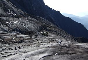
Dont get sloppy on the slope!
The real challenge for me started on the next day. Very, very early on the next day indeed. By 4 am I was already in the midst of struggling to grope the rope (and tried to do my best not to get myself strangled in the process…) in order to ascend the slope leading to the peak.
Now… the thing is…if you reached the summit too early, it will be too freezing cold to wait for the sunrise. So, listen to your Mountain Guide’s advise. He/She knows best. And for me, that last part of the climbing…with ropes and slippery slopes and all… that was the hardest! But then again… below here are the rewards…
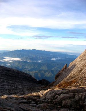
View from Top
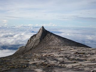
'Aki Nabalu': literally means 'Home of the Ancestral Spirits' in Kadazan/Dusun(the natives of Sabah)
So, every Malaysian (and also those who come to visit this blessed country), if you are able to find time and means, I would strongly recommend you to climb this beautiful, gorgeous mountain… at least once in your life time. Well… you don’t have to wait until the year 2012 to do that. Go now if you can. The experience is, honestly, beyond any words that I could print in here. But if I were to sum it up in only one word, the word would simply be… AWESOME!
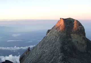
Sing now...'Shine on me...!'
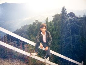
eSa @ Kinabalu Park. Before the climb
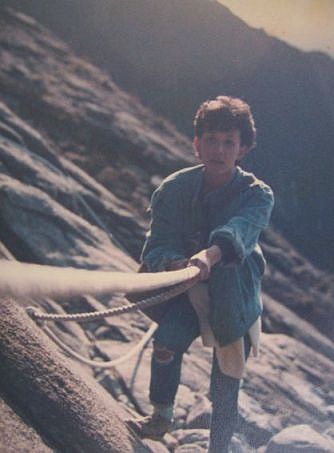
LifeLine

Yeeehaw! Made it to the Top! eSa clutching tight to the Visitors Record Book!

Living on the Edge
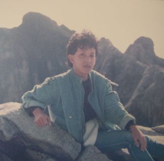
'Bad-Hair-Day' at the top

The strecth of beautiful white sand on Li Pe
My quest for the legendary & mythical ancient Malay kingdom of ‘Langkasuka’ next took me to another fascinating place. An ‘eden‘! A long-lost- and- only- now- newly found paradise! A small, immensely beautiful island called Li Pe. But my journey to this heavenly place had almost turned into a ‘nightmare’ …one that I would remember for a very long, long time…indeed.

A 'sampan' in the sea @ Li Pe
The eventful day started beautifully. It was sunny and bright when I took a ‘tuk-tuk’ from Pra Ae to the pier in LANTA town. And as scheduled, the ferry to Li Pe left Lanta sharp at 11 am. I was happy. Indeed, everything was so ‘honky-dory’ that I truly enjoyed the ferry ride till that moment…

2 Chao Lye (Sea Gypsies) kids playing swing on the beach
The ferry stopped at Koh Mok, and then again at Pak Bara (Satun) taking more passengers. I was later transferred to a smaller boat – more like a speed boat, really – in order to continue my journey to Li Pe. Luckily, the boat was almost half-empty. And I was the only Asian passengers, the rest being Europeans and a few Australians.

The beach-front chalet where I stayed @ Pattaya Beach, Li Pe
It started to rain when the boat left Pak Bara jetty. It was windy. Indeed, the wind was getting stronger as the boat went into the open sea. Not long after, the wind and rain became more forceful. I could see from the side of my window that the waves were as high as the boat itself! But the boat kept on moving forward.

View from the chalet's verandah
Now there was no more land or any island in sight. The sea was also cleared of any other sea-vessel. I was getting worried. The boat was rocked fiercely by the becoming-stronger waves. I could see panic and frightened look on other passengers faces, especially mothers with young children. Some of the kids started to cry. And one particular lady seated 2 rows behind me was crying while holding her 2 children.

Me in my newly found 'paradise'...
There were times when the boat felt as if it was about to be overturned by those choppy gigantic waves! Nevertheless, amidst all the suspense and confusion, the boat rode strongly cutting through the waves. When the boat fiinally approached Li Pe island and the rain and wind had subsided, I thanked GOD that we had safely reached our destination.
And what a destination it was! It looked like as if we had stumbled upon a long-lost paradise after braving a deadly storm! Just look at these pictures… Li Pe is truly a gem in the Andaman Sea. If you have the means & time, I would strongly recommend you to visit this paradise island before it turns into another Phuket, Pattaya, Langkawi, Pangkor or even Sa Moi!

Kids at Chao Lye village in Li Pe
QUICK FACTS of LI PE
Ferries –
frm Langkawi (Malaysia): depart from Telaga Harbor/twice a day- from November to May/ other months – only on weekends/ 1 hr ride
frm Pak Bara (Satun): daily – all year round
frm Lanta: daily – from November to May only.
NO jetty/pier at Li Pe – the local Chao Ley will fetch passengers with longtailboats from the ferry/boat and take them to the beach. Be ready to wade the knee-deep water before reaching the beach. Fee: about 50 BHT.
NO ATM on the island, but some resorts and chalets do accept credit cards.
NO cars on the island, except for a few motorbikes. So, people go around by walking! Good for YOU! By the way, Li Pe is such a small island (about 2 – 3 km wide) that you can do a full tour of the island in less than 2 hours!
 3 main beaches:
1) Pattaya Beach – the most popular
2) Sunset – the smallest
3) Sunrise – has small Chao Ley village
No…obviously I couldnt find even traces of that legendary and almost mythical ancient Malay Kindom of Langkasuka. Well…some scholars claimed that the kingdom was located on the east-coast of Southern Thailand (ie in the vicinity of Songkhla), while another group believe it was located on the west-coast (ie in Kedah, Malaysia). Its like… well… looking for an ‘Eden in the East’…!
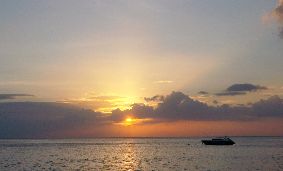
Captivating sunset viewed from Lanta beach
Hmmm…maybe they were ALL right? Being such a great & majestic kingdom of its time…maybe the kingdom was indeed located all the way from the most southern part of the Isthmus of Kra (that slim piece of land that separates South China Sea on the east from Andaman Sea on the west) stretching to the south right until Perlis, Kedah & Kelantan (the most northern states of Malaysia)? Hmmm…as always…me & my wild guesses:)
Anyway, on my ‘island-hopping-trip’ on the Andaman Sea, I came upon this beautiful place called…LANTA. So what if I didnt find a trace of Langkasuka?…at least I stumbled upon a lovely island which bears a name similar (well…only half of the name anyway) to that legendary kingdom. I was happy enough:)
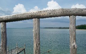
The calm sea viewed from the traditional jetty of Lanta
My ‘island-happy-hopping’ trip began in Krabi. After 3 nights in Krabi, I hopped into a boat that took me to Phi-Phi. Another 2 nights in that ‘tsunami-surviving’ island and then again I found myself on another boat that took me to Lanta. 3 nights in Lanta brought me to many beautiful, laidback, almost ‘tourist-free’ places on this lovely island.
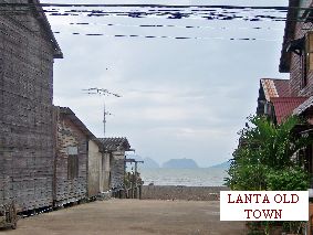
A narrow lane in between wooden shops in Lanta Old Town
The old name for Lanta was ‘Pulau Satak’. And that is ‘Satak Island’ in Malay. Yes, Lanta’s population consist of about 80% Malays. Anyway, the old name was later changed to ‘Lantas’ and finally in 1917 it was renamed ‘Lanta’.
There are actually 2 main islands in Lanta: Lanta Noi & Lanta Yai. The one that I went to was Lanta Yai.
Just a word of advice: if you are planning to go there (Lanta Yai) by taking the land route, just be prepared to spend sometime to board… not 1… but 2 ferries! The 1st one is from the main land (at Baan Hua Hin) and the 2nd one is to cross the small channel from Lanta Noi to Lanta Yai. At least that how it was a year ago.

Hard working Malay women of Lanta
Lanta was first populated by Sea Gypsies or locally called ‘Chao Lay’. They were believed to be originated from Aceh, Indonesia. That was 500 years ago. Then about 200 years ago, the island saw the emerging of Muslim community who came from the south, ie Malaysia and Indonesia. And finally, the Chinese made their way to island about 100 years later.

Me infront of a small 'boutique cafe' in Lanta Old Town
The ‘Chao Lay’ or Sea Gypsies formally lived a semi-nomadic lifestyle. The whole of Andaman Sea was their ‘home’. One interesting aspect that I managed to observe about the ‘Chao Lay’ is their passion in entertainment: a popular folk-dance called ‘Ronggeng’. This is actually also (eventhough not popular now like how it was before) one of the traditional dance in Malaysia! Another fascinating factor that I observed was that the popular local dishes of the islanders are ‘Massaman Curry’ and ‘Chicken Biryani’! Yes indeed, I felt so at ‘home’ on this lovely, lovely island!

Nice way to relax after a full-day of exploring Lanta Island

Could they be the descendants of the legendary & almost mythical ancient Malay Kingdom of Langkasuka...?
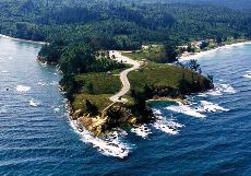
The Tip of Borneo
If Sabah was a woman, then Mount Kinabalu (highest peak in the Malay Archipelago region) would be the precious crown perched on her head and Sipadan Island would then be her awesomely mysterious heart. And… as for a place called ‘Simpang Mengayau’…that would definitely be the tip of her long, silky, sensous black hair! Sabah … a truly beautiful land endowed with many,many exotic, mysterious, beautiful and mesmerising sites. Exactly just like what one would have found in an awesome, hot, sultry woman. Well… as always… that was just me and my usual ‘over-the-top’ statement:)
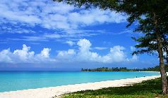
A little-bit-of-heaven...the beach of Simpang Mengayau
This time around I would love to share with you my experience visiting a place known as ‘The Tip of Borneo’, Simpang Mengayau. Needless to say, the pictures here would speak more volume than my words, but then again maybe there are a few interesting info about this gorgeous place that I could share with you here.
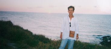
Look Behind! Thats where the two great seas meet!
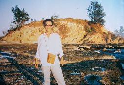
Me at the end of the road...
Simpang Mengayau is located about 50 km from Kudat town. By the way, Kudat was actually the first capital of Sabah from 1881 to 1883. Kudat is home to the Rungus people – one of the last few indigenous communities who still live in the longhouses. The beautiful, clean town of Kudat is situated only 200 km from the present capital city of Sabah, Kota Kinabalu. There is a good paved road that connects these two towns. Quite strangely enough (well, at least for me) Kudat and its surrounding areas are influenced by an ‘unpredictable’ weather condition…hence the longer than normal dry season experienced in this region.
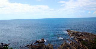
South China Sea on LEFT/ Sulu Sea on RIGHT
One can actually drive all the way from Kudat town to Simpang Mengayau. It takes approximately 30″ to reach this breathtaking spot from the town centre.

Simpang Mengayau Bay
The journey itself is so, so ‘AWESOMELY’ interesting! You will pass million of coconut trees and many small friendly villages. The beauty of the place is also enhanced by the presence of many pine trees lining up the road leading to Simpang Mengayau.
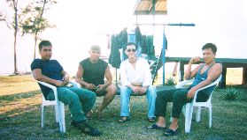
Friendly Soldiers of Simpang Mengayau Post
Mind you… if you were like me…you would probably end up taking much longer than the usual 30″ to reach the place! I just simply could not restrain myself from stopping at many beautiful spots along the way and thus the ‘prolonged’ travel time to the place.
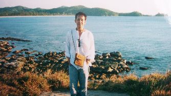
South China Sea in the background
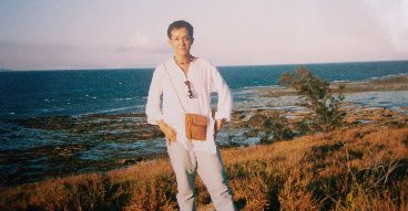
Sulu Sea in the background
Yes, you may have heard it before… Simpang Mengayau IS the place where the 2 great seas meet: the South China Sea and Sulu Sea. And yes, as you may have also heard, sunset viewed from this Tip of Borneo is truly a MIND BLOWING experience! I found out later they are very true indeed…and much, much MORE!
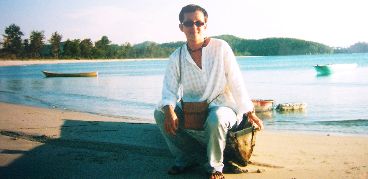
There’s also hardly any signs of modernisation here, just amazing views and all the tranquility that this place nature has blessed. And from the tip, you can clearly see the islands of Banggi, Mantanani and the triangle-shaped Kelambu Island.

This country has been blessed with many heavenly 'edens'...
I’m not so sure how I can explain it to you in words…you really have to visit the place to experience it. All I can say is that… the experience I had at Simpang Mengayau was so … so… sensous! So, dont be surprise if you heard me saying that the place is so ‘sexy and sultry’. Dont believe it? Try it yourself…and share with me & other readers of what you think about Simpang Mengayau. I bet you would be saying… the place is truly awesome!
During my brief stay in Pekan recently, my Uncle (thanks, Luke!) took me to a very small village which was occupied by the Aboriginal people. Yes… the ‘Orang Asal’ (literally translated as ‘original people’) village. A sub-group of the many groups of the indigenous people of the Malay Archipelago region.

An 'Orang Asal' boy
Very interesting. Very engaging experience for me. And, yes, they were (the ‘Orang Asal’ people) really, really very shy, humble and yet absolutely friendly and welcoming.
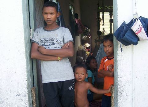
The 'Orang Asal' boy and family
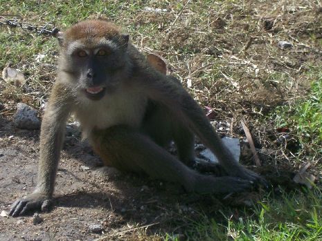
A pet-monkey belongs to the 'Orang Asal' family
Frankly speaking, that was my very ‘first-hand’ experience with them. But, you bet, it would definitely not going to be my last one. From that moment, I had made a promise to myself that I would definitely like to be with and around them more often in the future. Those genuine smile… those sparkling sincere eyes… those gentle gestures… there were so… very original! Very ‘Asal’!
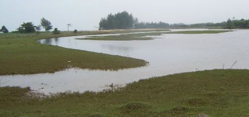
A calm, beautiful lake by the sea in Pekan
This serene looking lake located just few metres away from the beach of the South China Sea is just one of the many, many beautiful and mesmerising looking spots and sites which can be found in great abundance in and around the Malay Archipelago region. Waterfalls, natural hot springs, islands can easily be found within reach at almost all of the major cities and towns in the region.
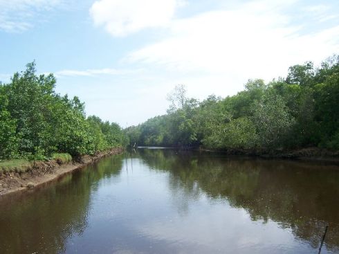
A water-canal in Pekan
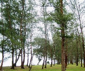
Line of Pine Trees by the sea, Pekan
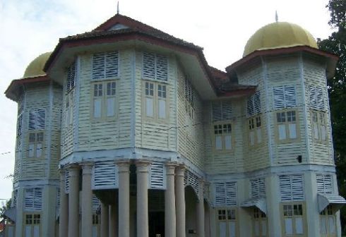
A library building, Pekan
Well… the building is not exactly as ‘hi-tech’ as the PETRONAS Twin Towers in Kuala Lumpur, yet I truly adore this charming structure. I used to come and play at the front of this house when I was small. Back then, it was just a scary looking abandoned big old mansion… the kind of place that remind me of those black & white ‘Frankestein’ movies!

Salted marine products left to be dried-up on the pavement of Pekan town
The Malay Archipelago region is ‘bursting’ with loads and tons of marine and natural traditional products. A truly multi-colored and multi-layered presentations of exotic, unique goods and products… and yet, surprisingly, they are good for one’s soul and friendly to the nature too!
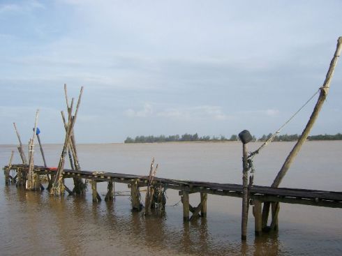
A traditional jetty, Pekan
Where on earth is PEKAN?
Pekan is located on the east-coast part of Peninsular Malaysia. It is about 4 hours drive from Kuala Lumpur.
How to get there?
From Kuala Lumpur, take the Karak Highway and then continue the journey on the East Coast Highway. Exit at Gambang and continue on the trunk road leading to Kuantan town. Take Note: Before reaching Kuantan, look out for ‘Pekan’ signboard. Follow the direction (you need to make a ‘U’ turn and almost right away after that to turn to left) and you will be in Pekan in no time at all.
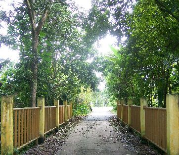
I chose a small town called ‘Pekan’ to be featured in this very 1st post of mine for many reasons. Yeah… mostly they are personal. This is the town where I had spent the first 7 years of my life. My earliest ‘playground’. Indeed, my very first ‘playground’ in the vast region of the Malay Archipelago.
And boy oh boy… I had so many playmates to go around with back then… never mind the fact that they were all my uncles, aunties, cousins, second cousins and so on. In short, they were all, somehow, related to me.
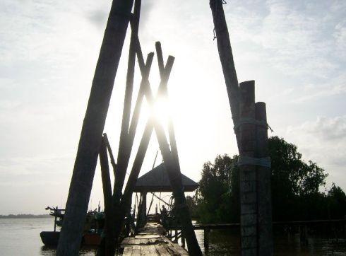
Sunset at a Traditional Jetty, Pekan
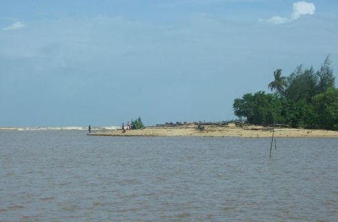
Where the river meets the sea... estuary at Pekan
But that was how it was for almost everyone else in Pekan too, back then. A small charming, serene little ‘cowboy-town’ which was populated mostly by one’s relatives!
I went back to Pekan recently for a brief stay. And… off course… I could no more claim any Mat, Minah and Mail whom I met was my uncle, auntie or cousin.
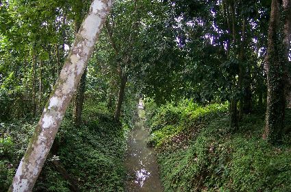
A serene looking drain that runs through a village in Pekan
These two pictures here are examples of the many, many beautiful sites found in and around the Malay Archipelago region. The region showcases hundreds of exotic spots like waterfalls, natural hot springs, islands, beaches, highlands and many many more. Heavenly good retreat sites for one’s soul!
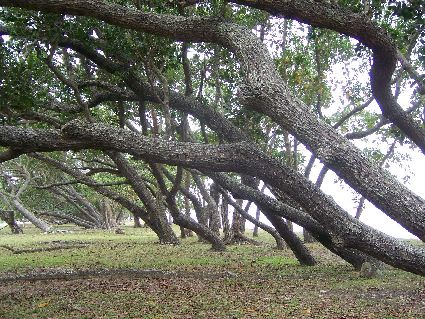
'Bow-Down' trees at a beach in Pekan
In short, there are many, many more people in Pekan now. And many, many of these many, many people originally come from other parts of Malaysia (or even … from other countries!).
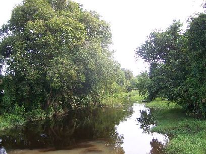
A water-canal in Pekan
Parts of Pekan town have also gone through some changes and developments. I guess it is for the sake of improving lives and economy of the residents. Very noble intention, indeed. But I was getting a little bit worried if the rustic charm of the ‘old’ Pekan would eventually be ‘sacrificed’ in the name of progress and modernisation.
I re-visited some of my ‘all-time-favourite-spots’ in and around Pekan. I was relieved to see that most parts of these sites were left quite ‘untouched’ .
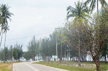
A road by the sea, Pekan
And while I was there, almost immediately, I was taken back to the time when I was still very small, running around and abound accompanied by my many, many uncles, aunties, cousins, second cousins and so on. Awesome!
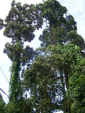
The 'Twin Towers' of Pekan
I stumbled upon these two very tall trees in a village called ‘Parit’ in Pekan. They reminded me of those ‘other’ tall structures back in the city… the PETRONAS Twin Towers 🙂
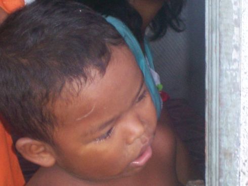
An 'Orang Asal' (Aborigine) Boy
Where on earth is PEKAN?
Pekan is located on the east-coast part of Peninsular Malaysia. It is about 4 hours drive from Kuala Lumpur.
How to get there?
From Kuala Lumpur, take the Karak Highway and then continue the journey on the East Coast Highway. Exit at Gambang and continue on the trunk road leading to Kuantan town. Take Note: Before reaching Kuantan, look out for ‘Pekan’ signboard. Follow the direction (you need to make a ‘U’ turn and almost right away after that to turn to left) and you will be in Pekan in no time at all.

- Me and ‘Mini Tsunami’


