You are currently browsing the category archive for the ‘Travel’ category.
Located in the middle of South China Sea, between east (Borneo) & west (Peninsula) Malaysia, lies the stunningly beautiful archipelago of Natuna Islands.
Officially a part of the Riau Archipelago province, Natuna Islands is actually the northernmost group of islands of Indonesia. This 272-islands archipelago is indeed a true and true ‘eden’ of the sunken Sunda Shelf of the Malay Archipelago!
The ‘eden’ of Natuna Islands are the ‘scattered’ mountainous parts of the sunken Sundaland/Sunda Shelf which had managed to stay ‘afloat’ above the sea level.
Well…you see…at the height of the Last Ice Age (about 20,000 – 18,000 years ago), almost all of the South East Asia lands and seas (ie the Gulf of Thailand and the Java Sea) were all dry and thus formed a continent twice the size of India – called Sunda Shelf or Sundaland.
Dramatic and catastrophic rise in water level occurred between 8,000-7500 years ago (at the end of the Last Ice Age – the 3rd Great Flood).
Experts claimed that record shows that the sea indeed rose at least 120 metres during those 3 Great Floods! The flooding of South East Asia resulted in major loss of parts of the flat land of the Sunda Shelf.
Now…back to the present time… the archipelago of Natuna Islands offers unspoiled beaches – with landscape & culture that is absolutely worth a visit! They are also famous for their lovely woven textiles. And not forgetting… those graceful and mesmerising traditional dances too.
Natuna Besar Island (or locally known as ‘Ranai’) is the largest in size and also northernmost of the islands. Mount Ranai in the island is the highest mountain in the Natuna Archipelago (1,035m). It also has extensive accommodation facilities, ie hotels, resorts and inns. Despite of its size, Ranai town is indeed quite a lively place. There are traditional markets, large supermarkets and also modern medical facilities available on the island.
 According to local historians, the 1st ever habitant of Natuna Besar Island was a young boy from Siam (present day Thailand). He was ‘swept away’ on a log and marooned on the island. The boy was later known as ‘Demang Megat’. He was later married to a princess from the Kingdom of Johor (southernmost state in Peninsula Malaysia) by the name of Engku Fatimah.
 The archipelago of Natuna Islands are vitally important due to the fact that they actually sit in waters that carry MORE than HALF of the world’s supertanker traffic! And of course, fisheries resources are enormous!
But more importantly… very, very significant reserves of oil and gas are believed waiting to be exploited right under the sea! Indeed, some claimed that the largest gas fields in the WORLD has been found… right here!
So how one gets to enjoy the magical beauty of this ‘floating Eden’ of the sunken Sundaland? Well, the easiest way is to fly. Go to Batam and head straight to Hang Nadim Airport. The small Fokker aircraft seats 45 passengers and takes about 1.5 hours to reach Ranai Airport on the Natuna Besar Island. The price? US8O per pax/one way.
Alternative mode of transport? Well… you can ride a boat from Kijang Harbor of Tanjung Pinang, Bintan Island. The boat takes 12 hours to reach Natuna Besar Island and the service is available only once a week! Not a bad idea if you want to be ‘marooned’ for 7 days…continuously… on a lost- lovely- island of ‘eden’ of the long forgotten sunken Sundaland…:) Awesome!
Niah in Sarawak, Malaysia and the Nile of Egypt…two places which are vastly separated by lands, seas, cultures, traditions and peoples. And yet, when I visited Egypt not so long time ago I was astonished to find one obvious similarity in the ancient traditions of these two exotic lands…the burial ceremony of their loved ones… the ritual performed onto those ‘lovely bones‘ of the deceased dwellers of Niah and the Nile.

The wall paintings found in the Painted Cave of Niah depicting the boat journey of the dead into the afterlife. A feature in traditions shared by both the dwellers of Niah and the Nile...?
I had actually paid a visit to Niah some years prior to my holiday in Egypt. Back then, Niah was not as popular as a tourist destination as it is now. Hence, it was not a ‘smooth sailing’ event for me to get there. From Miri town (distance-110km) I had to take a bus to a place referred to as ‘Niah Rest Stop’. It was located on the Miri to Bintulu road. There was no direct bus from Miri (or even from Bintulu – distance:131km) to Niah then.

Niah Cave has 8 entrances - the biggest is the west entrance, also known as the 'WEST MOUTH' - one of the world's most spectacular cave entrances!
From ‘Niah Rest Stop’ I then hopped into a minibus to take me to the Niah Park Headquarter located in a place called Pengkalan Batu (about 3 km from Niah). I had to pay RM10 for the Park’s Entrance Fee (only RM5 for Child) and another RM5 for Camera Permit (and RM10 if you take a videocam with you).
 Now…to get to the cave, I had to take a small motorized ‘sampan’ to cross the Niah River.
Cost only RM1 per pax then. Not sure how much it costs now.
 After safely reached the other side of the river’s bank, I then I continued walking the 3km plank-walkway. The raised plank-way was built above a dark forest swamp and cut through a dense tropical rainforest.
 Upon finally reaching a cliff, the path started to ‘climb’. It looke like a ‘tunnel’ to me. Soon enough, the ‘tunnel’ opened up into the great ‘Dragon Mouth’… or better known as the West Mouth of the Niah Cave Complex.
The West Mouth is 60m high and 250m wide! It is indeed one of the world’s MOST spectacular cave entrance! It is believed that about 40,000 years ago the cave was populated by prehistoric men. To be precise… the dwellers were of the Paleolithic times (the earliest part of the Stone Age). Indeed, they were believed to be the earliest human in the South East Asia region!
 Today the caves remain important for locals for their birdnests and guano (bat & bird manures/faeces) collection. The birdsnest collectors use bamboo poles and ladders made from Belian wood (ironwood) to climb to the cave’s ceilings. It is believed that there are about 1/2 million swiflets live in the caves!
 Leaving the main cave behind, i then continued to the next ‘attraction’ – the ‘Painted Cave’. I had to pass through another cave called ‘Moon Cave’, walked in almost total darkness for awhile before emerging into daylight. A short trail followed and before I knew it, I was already standing inside the ‘Painted Cave’.
‘Painted Cave’ houses wall-paintings depicting the boat journey of the dead into the afterlife. The site is believed to be the burial sites of people of the Paleolithic and Neolithic times. Set on the cave wall were numerous paintings of ‘boats’ loaded with up to 20 people. Some crumbling dug-out canoes, which had acted as coffins, were also placed against the wall of the cave.
Back then, I had not paid that much attention to the significant of those paintings and ‘death canoes’. And it never crossed my mind that I would be seeing something similar in places thousand of miles apart and some seas away from this humble cave of Niah. The ancient people of these two places seemed to have had shared the same ritual in putting the ‘lovely bones‘ of their loved ones to rest. And…’that’ other place I meant was no other than … the land of pyramids, pharaohs and the Nile… Egypt!
…of Niah & Nile
QUICKIES
There are now direct buses to Batu Niah from Miri and Bintulu…
Miri – from the Miri Bus Station – ‘quite’ regular – 1 hr to 2 hrs journey time
Bintulu – from the Bintulu Bus Station – 2 to 3 hrs journey time
Batu Niah to Niah HQ (Pengkalan Batu) – there are 3 alternatives:
1) motorized boat
2) taxi
3) walking – 45″ stroll along the riverbank
The Niah Cave Park opens from 8am to 5pm.
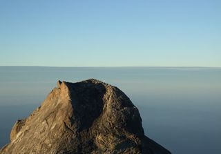 Mount Kinabalu in Sabah is indeed one of the youngest non-volcanic mountains in the world! Its majestic peak tops out at 4,095m and is easily recognized as the highest mountain in the Malay Archipelago region.
Now… many of us have seen that ‘horrifying’ sequence trailer of the very much anticipated ‘2012’ movie (attached below). And some even commented that if ‘ it’ was really to happen… would Mount Kinabalu be the safest bet to escape that catastrophic event within this region?
Errr… wellll… I don’t know about that. Indeed I don’t really believe that it would actually happen (as depicted in the movie). But then again… in this post I would like to share with you my own experience of climbing this gorgeous mountain. Yeah, it was yearsss ago when I first ascended the summit of Kinabalu. So, be warned, some of the photos you see here are quite old, really:) But the experience has always been fresh and new on my mind… forever.
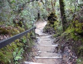
Stairways to Heaven...
Good thing is, no climbing experience is really required to conquer the peak of Borneo… that is if you take the main route. So, like many other ordinary average people, I started from the main starting point located in the Kinabalu Park. The park is located less than 2 hours drive from Kota Kinabalu, the capital city of Sabah.
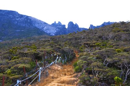
When the going gets tough...
Average person, me very much included…:) takes about 4 to 6 hours to reach about 3/4 of the way to the summit. This mid-way spot is called Panar Laban(3,270m).
I was also informed that presently the Sabah Parks limits the number of climbers to only 192 people a day. Why such an odd figure, eh?
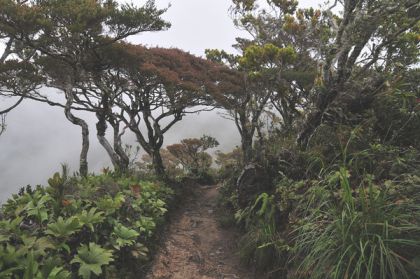
Dreamy Ascend...
Anyway, given the popularity of the Mount Kinabalu, it is advisable to book your adventure/climbing at least 3-4 months in advance! Indeed, some have claimed that they have to book as early as 6 months prior the climbing! Whoa! Try to beat that! Truth is… Mount Kinabalu is really, truly that immensely popular. And why not? The site has even been declared by UNESCO as a WORLD HERITAGE SITE. So there you go…
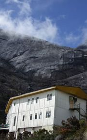
Finally... after 4 hours of climbing... catch the glimpse of your 'Reward-Of-The-Day'!
I finally reached Panar Laban where I stayed overnight at the Laban Rata Rest House. Mind you, camping is a big ‘NO, NO!’ (as strictly stipulated in the National Park’s rules & regulations). So, you are left with the choice of very limited accommodation choices. There are actually other accommodations ‘available’ beside the Laban Rata Rest House, ie ‘Gunting Lagadan’ and ‘Sayat Sayat Huts’. And that’s about it:( So, sadly, in the event that there is no accommodation available here, it is not possible for you to continue with your climbing plan. And, oh yeah, a Mountain Guide is compulsory.
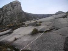
Now... the 'real' climbing starts
At that time I had to pay only RM30 for a bed (in a dorm). And RM10 for dinner… a bowl of Instant Noodle Soup! I thought that was already wayyy too much for me. But listen to this… the current price for a bed plus meals (a packed box, buffet lunch, dinner & breakfast) for one person is a whopping RM330! And this rate is valid for Malaysians, Permanent Resident of the country and also for those with Malaysian working permits.
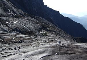
Dont get sloppy on the slope!
The real challenge for me started on the next day. Very, very early on the next day indeed. By 4 am I was already in the midst of struggling to grope the rope (and tried to do my best not to get myself strangled in the process…) in order to ascend the slope leading to the peak.
Now… the thing is…if you reached the summit too early, it will be too freezing cold to wait for the sunrise. So, listen to your Mountain Guide’s advise. He/She knows best. And for me, that last part of the climbing…with ropes and slippery slopes and all… that was the hardest! But then again… below here are the rewards…
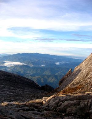
View from Top
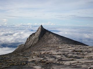
'Aki Nabalu': literally means 'Home of the Ancestral Spirits' in Kadazan/Dusun(the natives of Sabah)
So, every Malaysian (and also those who come to visit this blessed country), if you are able to find time and means, I would strongly recommend you to climb this beautiful, gorgeous mountain… at least once in your life time. Well… you don’t have to wait until the year 2012 to do that. Go now if you can. The experience is, honestly, beyond any words that I could print in here. But if I were to sum it up in only one word, the word would simply be… AWESOME!
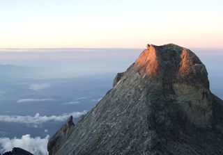
Sing now...'Shine on me...!'
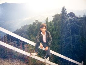
eSa @ Kinabalu Park. Before the climb
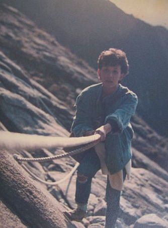
LifeLine

Yeeehaw! Made it to the Top! eSa clutching tight to the Visitors Record Book!

Living on the Edge
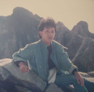
'Bad-Hair-Day' at the top

- Fascinating fishing villages of RIAU
Riau Archipelago was once THE heartland of the Malays of the Malay Archipelago region. Indeed, it was here that the 1st ever book of Malay Grammar , the ‘Bustanul Katibin’ was written & published in 1857. So, it is not surprising to know that this beautiful region is indeed the cradle of Indonesia’s Malay-based national language & culture.
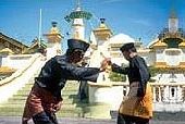
'Silat' - Malay art of self-defense
So with that thought on mind, I decided to take a ‘peek’ at this fascinating clutters of edens. Accompanied by a dear friend from the Philippines, I started my ‘Malay soul-searching’ trip by boarding a boat from Setualang Laut, Johor, Malaysia heading to Batu Ampar Port of Batam. Batam is the nearest island of the Riau Archipelago to Malaysian & Singaporean shores. The one-way boat ride cost RM56 (including Port Tax).
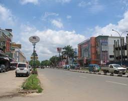
Nagoya Town, BATAM.
From the port, we hopped onto two ‘motorbike taxis’ and headed straight to Nagoya Town. RP5000 for the ride. We then went to look for a room and finally settled with a small, clean room located right in the heart of the town. After few hours of going around town, I then decided that I did’nt really fancy Batam at all! Batam to me is nothing more than a ‘playground’ for Singaporean (and some Malaysian too, I suppose). Of course, due to its strategic proximity to Singapore, Batam has also been designated as a centre of industry and trade for the region. Whatever. Truth was, I couldnt wait to get out of Batam at the soonest possible time and to continue exploring further into the very heart of the Riau Archipelago… and maybe even try to go beyond that.
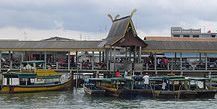
The main jetty of Tanjung Pinang, BINTAN Island, RIAU.
So, early next morning, we took a cab to Telaga Punggur Port. The cab ride cost us RP30,000. We hopped into a boat and about 1 hour later we were already at the Tanjung Pinang Jetty of Bintan Island. I immediately liked what I saw and knew that we had made a good decision:)
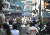
Interesting crowd on main street of Tanjung Pinang town of BINTAN
Tanjung Pinang on Bintan Island is a busy little town. A large section of the old port of this town was built in traditional local style – on stilts, over the water. Nice!
We took our own ‘sweet-time’ and enjoyed the ‘energy’ of the town. We had tea at a nice roadside kiosk and chatted with some locals. They were very friendly and helpful indeed. Well, we even managed to get some ‘tips’ on good accommodation on the island!

eSa & friend @ Tanjung Pinang Corniche. The rest-house where we stayed in was located on top of the hill in the background of this photo. A room with a view... awesome view, indeed!
We decided to stay at an old rest-house located on top of a hill overlooking the sea & part of Tanjung Pinang town.
The view from the room’s balcony was AWESOME! We could clearly see the Penyengat Island and its famous landmark, the bright yellow color building of the Sultan Masjid.
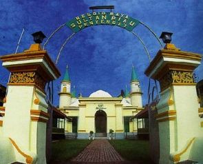
The Sultan masjid of Penyengat Island. Some locals claimed that in the past, the 'masjid' was painted bright yellow by using egg-yolks! Whoa! How much egg-yolks do you think they had to use in order to achieve that effect? Awesome!
The next day, we took a small ‘sampan’ (a small sailing vessel) and sailed across to Penyengat Island. Cost us only RP5,000. The very first thing I noticed when I stepped onto the island: the whole place was sparkling clean! Really! I was impressed:)

eSa with 'beautiful souls' of Penyengat Island
And then… oh those children! Runing around everywhere with their bright smiles and warm greetings. ‘Assalamualaikum’ (Muslim greeting) was heard over and over again… in every nook & corner that we went.
Well, we were even invited by a middle-aged woman and her children to join them for a feast of grilled fish! They were grilling their fishes when we passed by their house. You bet, we did not even think twice and gladly accepted her generous offer. So, there we were… sitting under a big, shady tree… surrounded by small little ‘angels’… and grilling some fishes while chatting-away happily.
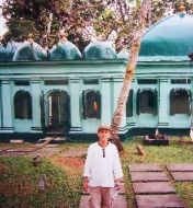
eSa @ 'Green Grave' Complex
Truth to be told, I was actually almost brought to tears when such warmth and friendliness was extended to us… strangers from no where… and being greeted in such manner by the islanders. And this was especially true with the kids of this tiny island. Lovely, beautiful souls of the island. Erm. I sound a bit melancholic and sentimental now, am I not? Well… blame it on RIAU:)
We continued exploring the island and visited some ancient masoleums of significant personalities of the Riau Malay kingdom, ie Engku Puteri and Haji Ali. We also ventured into old palaces of Engku Puteri and Engku Bilik. According to the locals, ‘Penyengat Island’ was actually a ‘wedding gift’ by Sultan Mahmud to his bride Engku Puteri who was the daughter of Raja Ali Haji. Ermmm… how romantic.

One of the many old & abandoned palaces & villas found scattered on the tiny island of Penyengat. This one belonged to Engku Bilik - an inlfuential figure of the by-gone 'Golden-Era' of RIAU Malay Kingdom
Since then, Penyengat Island had become THE centre of government, tradition, Islamic religion and Malay culture. Indeed, Bintan and Penyengat islands have been known among the dwellers of the Malay Archipelago region as the ‘doorstep of history’.
The famous Arab explorer who was known as the ‘Arabian Marco Polo’ – Ibn Battuta – had been claimed to have said “Here there are little islands, from which armed black pirates emerged, possessing armed warships; they plunder people BUT do not enslave them” when referring to the islands of Riau Archipelago.
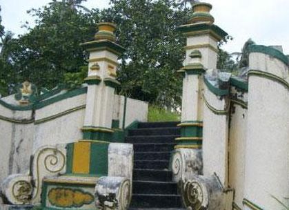
Stairs leading to an old palace on Penyengat Island
“Tanah air tinggal airnya, Kolong berserakan, Singapura timbul, Singkep tenggelam…”. Loosely translated : ‘ The land (island) is left only with water (and no land/soil on sight), the hollow cavings are scattered all over the place, Singapore risen, while Singkep is sinking…’ . This poetic statement by a blogger named Socrates aptly described the next island that we visited, Singkep Island.
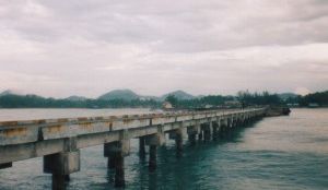
Possibly, the longest jetty in the Malay Archipelago region: Jetty of Singkep Island
Singkep is located at the most end of the Riau Archipelago region. So, I did fulfill a promise to myself of wanting to venture right to the end of the archipelago… and maybe to go even beyond that.
The boat trip to Dabo, Singkep island itself was truly an awesome experience.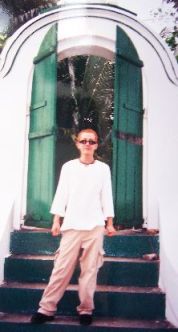 Almost magical, indeed! Almost immediately after the boat left Tanjung Pinang, we were confronted with awesome views of numerous islands, mountain peaks peeking out of the clouds, lonely ‘kelongs’ (fishing huts on pillars) rose from the calm and shallow sea, small huts and houses scattered along the waterside… but most awesomely was the fuzzy contours of Daik Mountain which begun to appear as the boat was approaching the Lingga Island. Immortalised by the Malay in their famous poems of ‘Gunung Daik Bercabang Tiga’ (Daik Mountain with its 3 sharp peaks), the mountain has served as the symbol of strenght and durability for the Malays since aeons ago.
Sadly, though, when we arrived at Singkep Island, we almost immediately realised that this was a very sad place, indeed. When we asked around, one local had even answered us by comparing the present condition of the island to a “negeri dilanggar Garuda” ( a land which is left devastated by the attack of a ‘Garuda’ – a mythical giant bird ).
Indeed. The small Singkep Island was full of holes! Deep, hollow holes. These horrible environmental casualty was the result of hundred of years of tin mining activities. And to make things worst, the sand/soil of this tiny island has also been ‘exploited to the hilt’ in the recent years. Not to mention the abuse of the island’s already- very- limited wealth of the forest. Indeed, if Singkep Island is viewed from above, it may well look like as if the island has been ripped apart… savagely! And by night time (yes…we did spend a night on Singkep Island), as early as 8pm, the whole town was turned into a VERY, VERY quiet and eerie looking place! With its ‘extra dimmed’ street lights (they were ‘extremely’ dimmed, somehow, for some unknown reasons … lack of electric supply maybe?) , the town looked like a backdrop of scenes in horror movies! Really sad. Almost tragic.
Well, after all said and written about Singkep Island, let us not too quick to make any judgement, though. In other words, let us not 100% to… Blame It On RIAU.
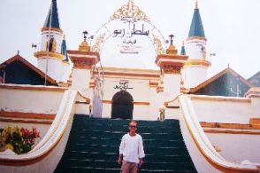
eSa @ Sultan Masjid, Penyengat Island
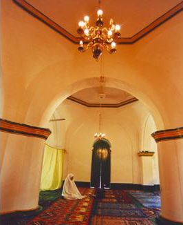
Wishing Malaysians a very MEANINGFUL MERDEKA! And to Muslim readers, ‘RAMADHAN AL MUBARAK!’…
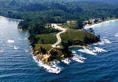
The Tip of Borneo
If Sabah was a woman, then Mount Kinabalu (highest peak in the Malay Archipelago region) would be the precious crown perched on her head and Sipadan Island would then be her awesomely mysterious heart. And… as for a place called ‘Simpang Mengayau’…that would definitely be the tip of her long, silky, sensous black hair! Sabah … a truly beautiful land endowed with many,many exotic, mysterious, beautiful and mesmerising sites. Exactly just like what one would have found in an awesome, hot, sultry woman. Well… as always… that was just me and my usual ‘over-the-top’ statement:)
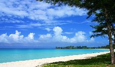
A little-bit-of-heaven...the beach of Simpang Mengayau
This time around I would love to share with you my experience visiting a place known as ‘The Tip of Borneo’, Simpang Mengayau. Needless to say, the pictures here would speak more volume than my words, but then again maybe there are a few interesting info about this gorgeous place that I could share with you here.
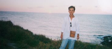
Look Behind! Thats where the two great seas meet!
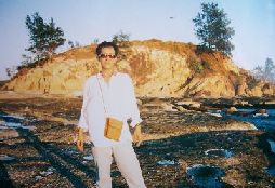
Me at the end of the road...
Simpang Mengayau is located about 50 km from Kudat town. By the way, Kudat was actually the first capital of Sabah from 1881 to 1883. Kudat is home to the Rungus people – one of the last few indigenous communities who still live in the longhouses. The beautiful, clean town of Kudat is situated only 200 km from the present capital city of Sabah, Kota Kinabalu. There is a good paved road that connects these two towns. Quite strangely enough (well, at least for me) Kudat and its surrounding areas are influenced by an ‘unpredictable’ weather condition…hence the longer than normal dry season experienced in this region.
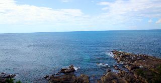
South China Sea on LEFT/ Sulu Sea on RIGHT
One can actually drive all the way from Kudat town to Simpang Mengayau. It takes approximately 30″ to reach this breathtaking spot from the town centre.

Simpang Mengayau Bay
The journey itself is so, so ‘AWESOMELY’ interesting! You will pass million of coconut trees and many small friendly villages. The beauty of the place is also enhanced by the presence of many pine trees lining up the road leading to Simpang Mengayau.
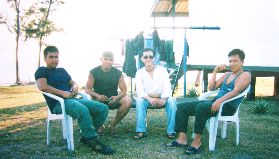
Friendly Soldiers of Simpang Mengayau Post
Mind you… if you were like me…you would probably end up taking much longer than the usual 30″ to reach the place! I just simply could not restrain myself from stopping at many beautiful spots along the way and thus the ‘prolonged’ travel time to the place.
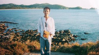
South China Sea in the background
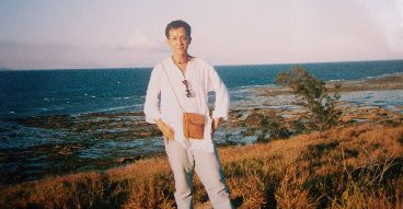
Sulu Sea in the background
Yes, you may have heard it before… Simpang Mengayau IS the place where the 2 great seas meet: the South China Sea and Sulu Sea. And yes, as you may have also heard, sunset viewed from this Tip of Borneo is truly a MIND BLOWING experience! I found out later they are very true indeed…and much, much MORE!

There’s also hardly any signs of modernisation here, just amazing views and all the tranquility that this place nature has blessed. And from the tip, you can clearly see the islands of Banggi, Mantanani and the triangle-shaped Kelambu Island.

This country has been blessed with many heavenly 'edens'...
I’m not so sure how I can explain it to you in words…you really have to visit the place to experience it. All I can say is that… the experience I had at Simpang Mengayau was so … so… sensous! So, dont be surprise if you heard me saying that the place is so ‘sexy and sultry’. Dont believe it? Try it yourself…and share with me & other readers of what you think about Simpang Mengayau. I bet you would be saying… the place is truly awesome!


